
Whatcom County ZIP Service Areas
The county-source mapping document identifies 18 local service mappings. It supplies postal city labels, not neighborhood boundaries or a count of residents. Three are specifically labeled for post office boxes. The remaining codes identify service areas tied to the named place. This is the core coverage table for the Whatcom County ZIP code directory.
| ZIP Code | Areas Covered | Post Office | Notes |
|---|---|---|---|
| 98220 | Acme service area | Acme | County local mapping |
| 98225, 98226, 98229 | Bellingham service areas | Bellingham | 98229 was created in 2002 |
| 98227, 98228 | Bellingham boxes | Bellingham | PO Box labels |
| 98230 | Blaine service area | Blaine | Street delivery label |
| 98231 | Blaine boxes | Blaine | PO Box label |
| 98240, 98244, 98247, 98248 | Custer, Deming, Everson, Ferndale | Named local post offices | Distinct rural and city routes |
| 98262, 98264, 98266 | Lummi Island, Lynden, Maple Falls | Named local post offices | Island and inland service |
| 98276, 98281, 98295 | Nooksack, Point Roberts, Sumas | Named local post offices | Includes geographically unusual Point Roberts |
No official neighborhood-to-ZIP crosswalk was found. Do not assign a whole Bellingham neighborhood to one code from a visual guess. A street, parcel, neighborhood, postal route, and city line can overlap in several ways.
Verify a Whatcom ZIP
The official USPS ZIP Code Lookup offers three different searches. By Address uses a street address with city and state, plus an optional company or unit. By City & State returns postal codes tied to a place label. Cities by ZIP reverses the question and returns recognized city names for a code. Choose the mode that matches the facts in hand.
| USPS mode | Fields | Use | Limit |
|---|---|---|---|
| By Address | Street, city, state; unit optional | Resolve a full mailing ZIP | Multiple matches need more address detail |
| By City & State | City and state | List codes for a postal city | Does not draw city limits |
| Cities by ZIP | ZIP | Check accepted city wording | Does not prove residency |
USPS warns that a returned result does not prove a person or business is present. It confirms routing. Save the search mode and access date beside the ZIP code directory result.
Whatcom ZIP Changes by Date
Two postal bulletins show why an old code should not be replaced without noting the year. Effective July 1, 2002, USPS moved 11,679 deliveries from 98226 into the new 98229 Bellingham code. Effective September 1, 2010, it moved 13 deliveries from 98247 Everson to 98264 Lynden. The street did not need to move for its routing label to change.
- 2002: Preserve 98226 on records created before the Bellingham reassignment.
- 2010: Test both 98247 and 98264 for the affected Everson-area trail.
- Current check: Confirm today's result through USPS, then keep the historic code beside each older source.
This comparison is one of the most useful quirks in the Whatcom County ZIP code directory. A mismatch between two dated records may reflect postal administration, not a different person or place.
Find Whatcom Residents by ZIP
A ZIP code directory should narrow the place before a name is tested in a record. USPS accepts a ZIP directly, and the County ArcGIS layer supports ZIP polygon queries. The Assessor has street, city, owner, Property ID, and Geo ID fields, but the source review found no evidence that ZIP is a primary property-search field. Whatcom voter requests can target districts or precincts, not a casual ZIP resident list.
- Check the full address in USPS. If only the ZIP is known, use Cities by ZIP and record each accepted city label.
- Query the Whatcom County ZIP layer. Treat its polygon as a map reference, not a legal boundary.
- Use the street and city in County Property Search. Save the parcel or Geo ID returned for the correct address.
- Confirm names only in records that lawfully expose them. Respect voter-use certification and protected-address rules.
Once a postal area narrows to an address, continue with the Whatcom County street directory. That workflow separates parcel ownership, deed parties, and historical occupants instead of treating a ZIP match as proof.
Edge ZIPs on Whatcom Maps
The County GIS extent also displays polygons labeled 98237 Concrete, 98244 Glacier, 98283 Rockport, and 98284 Sedro-Woolley. These labels are useful signals near shared or edge geography. They are not part of the county document's 18 local service mappings, and they should not be presented as ordinary Whatcom County postal municipalities without a boundary check.
The ZIP ArcGIS data includes OBJECTID, ZIPCODE, ZIP, Municipality, and Shape fields. Its municipality value is a layer attribute, not a legal finding about the city that governs a parcel. Query the polygon, check the parcel separately, and use USPS to confirm mailing format.
Inspect the official Whatcom ZIP GIS layer for its current fields and service status.
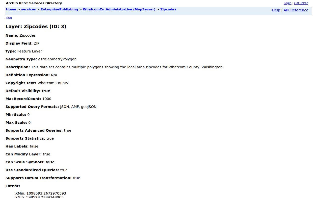
The captured service view supports geographic checks while keeping postal routing and legal city boundaries as separate questions.
Record a Whatcom ZIP Match
A simple research card prevents a postal result from turning into an unsupported identity claim. Record the five-digit code, the recognized USPS city wording, the county, the map source, and the date checked. Add the full address only when it is lawful and needed for the personal research task.
- ZIP code
- A five-digit USPS routing code. It is not a municipal boundary.
- ZIP+4
- A more precise delivery segment appended to the five-digit code.
- PO Box ZIP
- A code or label used for box delivery at a post office, such as the county-listed Bellingham and Blaine box mappings.
- Carrier route
- A delivery sequence used by USPS. It is not a resident roll.
The USPS AIS Viewer adds ZIP+4, delivery type, county retrieval, and monthly update information. Its data tools are not an exportable Whatcom residents directory. Use them to validate mail geography, then return to the correct official record custodian.
Whatcom PO Box Labels
The local county mapping document marks 98227 and 98228 as Bellingham PO Box labels and 98231 as a Blaine PO Box label. A box routes mail to a post office. It does not locate a home, define a neighborhood, or show who occupies a street address. This makes PO Box codes poor starting points for parcel work.
If a historical document gives only a box, keep that fact in the record card and look for a separate street address in a deed, directory, permit, or other lawful source. Do not infer a physical location from the box holder's name. That caution is especially important where the Address Confidentiality Program supplies a substitute address.
Whatcom ZIP Neighborhood Gaps
Bellingham recognizes 25 named neighborhoods, including Fairhaven, Sehome, Lettered Streets, Cordata, Birchwood, and Whatcom Falls. The official city neighborhood page and its maps are good sources for those civic boundaries. They do not provide a complete neighborhood-to-ZIP crosswalk, and the research did not locate one in an official county or city source.
Keep that gap explicit. First verify the ZIP through USPS, then place the address in the city neighborhood map and the County parcel layer as separate checks. Do not assign all homes in a neighborhood to one postal code from a rough visual overlap. The ZIP code directory records routing, while a neighborhood map records local planning or civic geography. Their lines can cross, and either source may be revised on a different date.
The neighborhood list includes Alabama Hill, Barkley, Birchwood, City Center, Columbia, Cordata, Cornwall Park, Edgemoor, Fairhaven, Happy Valley, Irongate, King Mountain, Lettered Streets, Meridian, Puget, Roosevelt, Samish, Sehome, Silver Beach, South, South Hill, Sunnyland, Whatcom Falls, and York. Western Washington University appears as a related row in the advisory commission table. Association links can identify civic contacts, but they are not member or resident rosters.
For a reproducible match, save the neighborhood map date, parcel ID, postal lookup date, and the exact address form used. If the sources disagree, report both labels and their purposes. A dated mismatch is more useful than forcing several geographic systems into one answer.
Whatcom ZIPs Versus City Limits
A postal city name tells USPS how to route mail. It does not establish that an address lies within that city's legal boundary. The same is true of the Municipality field in County GIS. Bellingham neighborhoods, city limits, county parcels, voter precincts, and postal areas use different lines and may update on different schedules.
- Postal label
- The city wording USPS accepts for delivery.
- Municipality
- An incorporated government area, or a field label in a particular GIS layer depending on context.
- Neighborhood
- A locally recognized area whose boundary does not necessarily follow a ZIP polygon.
- Parcel
- A unit used for property assessment and mapping; the deed supplies its legal description.
Washington's Address Confidentiality Program is a firm stop. If a public workflow shows a substitute address, do not try to connect it to a protected physical address. ZIP code lookup results are for lawful routing and research, never for stalking, harassment, or exposing someone whose address is protected.
Boundary check. Confirm postal routing with USPS, parcel geography with Whatcom County, and city jurisdiction with the relevant municipal map.
The Whatcom County ZIP code directory is strongest when each result states what it proves. A USPS match proves current routing, a GIS polygon shows mapped geography, and a parcel record identifies taxable property. None by itself proves where a person currently lives.